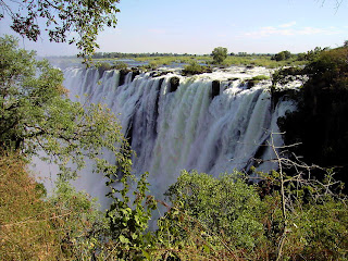
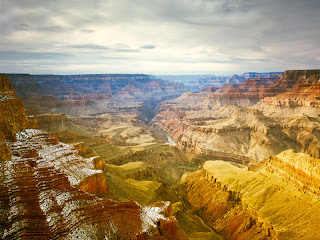
The Great Barrier Reef
 The Great Barrier Reef image courtsey: eb.com
The treasure of Oceania.
The region of the mid-south Pacific Ocean where Australia, New Zealand and numerous small islands (about 25,000) scattered is known as the Oceania. The Oceania has much geographical exclusivities for its credit; but Great Barrier Reef that spans 2000 kms near Australia is the most prominent among them. It is the largest coral reef in the world (the second largest is the Belize Barrier Reef of Central America) located in the Coral Sea off north–east part of Australia almost parallel to Queen’s Land. This rare natural wonder comprises of about 900 islands and more than 3000 coral platforms all formed by millions of years of biological activity has been approved as the icon of Queen’s Land.
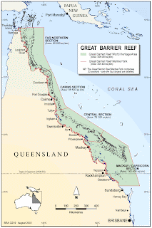
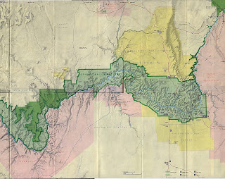
Great Barrier Reef Map courtsey: gbrmpa.gov.au
The Coral Polyps, their self less service.
Unbelievable but true is the fact that these huge ‘mountains’ are aragonite structures created by a type of miniature animals known as ‘Coral Polyps’ belonging to the group of Sea Anemones and Jelly Fishes (colonial cnidarians). The Coral Polyps are very special types of ‘animals’ which are shaped like flowers, and live in enormous colonies consisting of billions of such animals. Each animal during its life span leaves an amount of calcium deposit (which functions as their exoskeleton) on which a new one finds its shelter thus the process goes on. These so called animals have no brain, heart, ear or even eyes, are engaged twenty four hours in absorbing calcium rich minerals from the surrounding sea water and converting it to hard calcium deposits that is the coral reef, a self less service for the welfare of the mother earth!
Symbiosis.
The lives of the Coral Polyps are dependent (rather it is a symbiotic relationship) on a special type of algae by name Zooxanthellae. Coral Polyps carry these yellowish brown algae in their body, Zooxanthellae produce necessary oxygen for the breathing and nutrients for the polyps in addition they help in the removal of wastes that get accumulated on its body. In return the algae get ‘lodging’ facility in the body (cytoplasm) of the polyps. This type of natural arrangement existing in nature between two types of being is known as symbiosis. The problem with symbiosis is that one animal cannot live without the other.
Barriers and Atolls, Bank Reef etc.
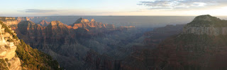
 The Great Barrier Reef image courtsey: smh.com.au
The Coral Reefs are of many types, Fringing Reef, found in the shallow waters of seacoast and leaves a shallow lagoon with beautiful fish varieties, The Apron reef, Barrier Reef is that remains detached from mainland looks like a mountain range. Patch Reef, Ribbon Reef, Table Reef etc are shaped as their names denote (Table Reefs are comparatively larger). Atoll is ring shaped group of islands (may be continuous) that encircle a lagoon. The Barrier Reefs are located off the coast and are dotted with deep water bodies in between coat and the reef. The groups of coral islands also have lakes with bluish water in between. These Great Barrier Reefs that stretch more than 2000 km in length occupy more than 20,000 sq kms and each year they are engaged in the manufacturing of 500 million tons of calcium compounds!
A unique eco-system.
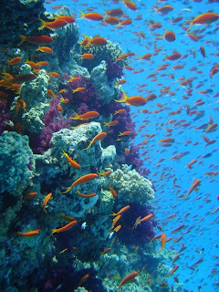
The Barrier Reef being a live mass require congenial atmosphere to flourish, temperature should be between 18 to 30 degree C, water should be saline and clear enough to allow sunrays in. Barrier reefs, Atolls and coral islands are all variants off same system. They jointly create a very rare and valuable eco system where numerous fish like Angel Fish, Parrot Fish, Damsel Fish, Butterfly Fish etc. algae, and many lower types of animals like Sea Cucumber, Shrimps, Spiny Lobsters, Star Fish etc. In a survey conducted in 1997 more than 93,000 species of plants and animals have been discovered from the barrier reef ecosystem. About one third of the total species of beings live in the barrier reef system. Deforestation makes the rivers filled with silt that flows direct in to the see.

Great Barrier Reef image courtsey: businessweek.com
A rude shock.
Deforestation is a main issue that works havoc on the reef, the disappearance of trees makes surface soil without support and it along with silt flows in to river and finally reaches in to the sea. These silt blocks sunlight beneath the sea and kill the symbiotic bacteria and thereby causing the death of the coral polyps. Industrial units discharge waste to the sea and effluents from crowded cities deposit it in to the sea. These effluents act like nutrients to some harmful bacteria and algae that invade the reef. All these are ringing death knell of this valuable system that has formed by billions of years. It is shocking to read that a major part of the barrier is on the verge of death.
A recognition.
The world has recognized the value and importance of the reef and it has been given the status of World Heritage Site by UNESCO in 1981. More than 2 million tourists visit the reef each year and Australian tourism is much dependent upon the reefs for its revenue sources. The responsibilities related with the protection of reef are entrusted with the Great Barrier Reef Marine Park Authority. This Authority has the hard task to protect the environment while facilitating amenities to the tourists who come from the whole part of the world for pleasure as well as study.
Tourism.
 Great Barrier Reef image courtsey: liveandletdive.googlepages.com
Tourism is the main income of the Great Barrier Reef area, the revenue it receives is over 1 billion dollars. The visitors to this reef are with varying demands some for sheer pleasure, others want to spent holidays in luxury, there are adventurers, and there are visitors who are aware of the rarity of the barrier reef phenomenon and want to understand it in person. Linder man, White Sunday, Hamilton, Day dream, Hook (all islands) Hardy Reef, Whit Heaven Beach are some of the destinations visited by cruisers, tourists can have sight seeing all around the places and avail great company along with.
Facilities.
There are about 700 approved tour operators of which more than 65% actively engaged in facilitating amenities to tourists. There are glass bottomed boats for viewing the corals by sitting in the boat, There are scuba diving facilities, semi submersible vessels, snorkeling gears (a tube and fittings to breathe while under shallow waters) rowing boats and etc provided. Those who are interested in fishing can pass time by catching fish. Those who have come to study the system has a good chance as educational tours are also here.
As it is in the case of most of the good tourists’ spots, here also the tourists who come for mere pleasure or just for spending a holiday; return with a lot of information and awareness; that they would never have acquired sitting at home.